ArcProgramming
|
|
|
Display Pictures Users' Manual
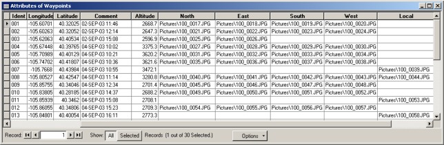
Display Pictures is an ArcGIS add-in. The purpose of this program is to display multiple pictures associated with a feature layer. The program searches the attributes of the selected feature for all strings ending in ".jpg", ".gif", ".bmp", and ".wmf". It then creates a list of these pictures for the user to select from. Example The example below was automatically generated by GPS2GIS. It contains fields for 5 different pictures (North, East, South, West, and Local) per feature. You may have as many fields as you like, with any name. You may use explicit or relative path names for the picture filenames. This example uses relative path names for the picture filenames. Relative paths relate to the location of the feature file. In this case the "Pictures" directory is located in the same directory as the Waypoint shapefile and all of the pictures are located in the "Pictures" directory.
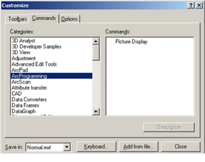
Installation Use "pkunzip" or "Winzip" to extract the executable (.dll) to your local hard drive. Select the "Tools" menu in ArcGIS and then click on "Customize". The dialog box shown below will appear. Click the "Add from file" button and then navigate to the location of the .dll file. Select the "ArcProgramming" category and then drag the "Picture Display" command to one of your tool bars.
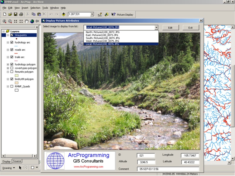
Usage Simply click on the "Picture
Display" tool
A subset of the attributes are displayed at the bottom of the dialog. The contents of the fields named "Ident", "Alt*", "Lat*", "Long*", and "Comment" are displayed. These fields are automatically generated by "GPS2GIS".
|
|
Copyright © 2002-2009 by ArcProgramming Last modified: 05/08/10 ESRI and ArcGIS are licensed trademarks of Environmental Systems Research Institute, IncArcProgramming is NOT associated with Environmental Systems Research Institute (ESRI).
|